Utility Mapping
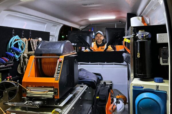
QEST Infrastructure is a provider of accurate and reliable utility mapping in Melbourne, Geelong, across Victoria and interstate. Our underground and geospatial team of experts have over 2 decades of on-the-ground and project management experience, and we take pride in being an industry leader. We are the only utility locating service provider delivering a holistic solution to underground infrastructure reporting including service location, utility mapping, geotechnical drilling and reporting, surveying, hydro excavation, 3D scanning, drone flight surveying, and CAD drafting. With one point of contact from project commencement to completion, our clients experience the convenience of “One call does it all”.
If you are considering whether you need a utility locating service for your project, there are several factors to first consider. Below we explain what utility mapping is, why utility locating is important, and why our clients have chosen to stay with us for years and even decades, to provide utility locating services.
If we have left any of your questions unanswered or you would like to know if QEST Infrastructure’s utility location services are right for your project, contact us today.
What is infrastructure/utility mapping and why is it important?
Utility mapping involves finding, identifying and documenting underground utility locations to provide clients a detailed picture of services within the vicinity of planned works, before any construction or excavation commences. These utility maps can also feed the design for construction. There are many services that can be found and identified such as water pipes, gas lines, telecommunications, and electrical cables, among others.
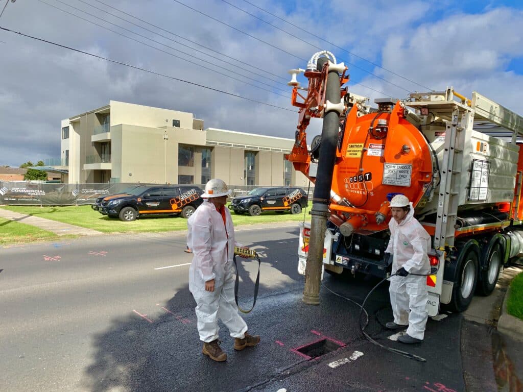
Accurate utility mapping is crucial to prevent damage to underground assets. Inadvertent asset strikes can cause serious injury, death or infrastructure damage with large penalties to be paid by the company responsible for the damage. At QEST Infrastructure, a key point of difference is our end-to-end service management, without the use of subcontractors. All of our services are provided by us, from the initial underground investigations and assessment, to the physical identification of located assets utilising hydro excavation. This technique is the only certain method to prove precise underground asset locations. By prioritising accuracy, our expert utility mapping services exceed expectations and ensure both project timelines and safety standards are met.
What does utility location mean?
Utility location is the process of identifying and locating underground utilities like water, sewer, gas, telecommunications, and electrical lines prior to excavation or construction. At QEST Infrastructure, we employ advanced technologies for underground utility locating, from electronic underground detection to hydro excavation —the only method to ensure positive asset location.
Utility locating aims to prevent damage to utilities and services during excavation or construction activities, which poses significant risks for workers’ safety and potentially costly repairs and delays. Our expert utility mapping services ensure a thorough understanding of your project site, actively reducing these risks.
How does infrastructure/utility mapping work?
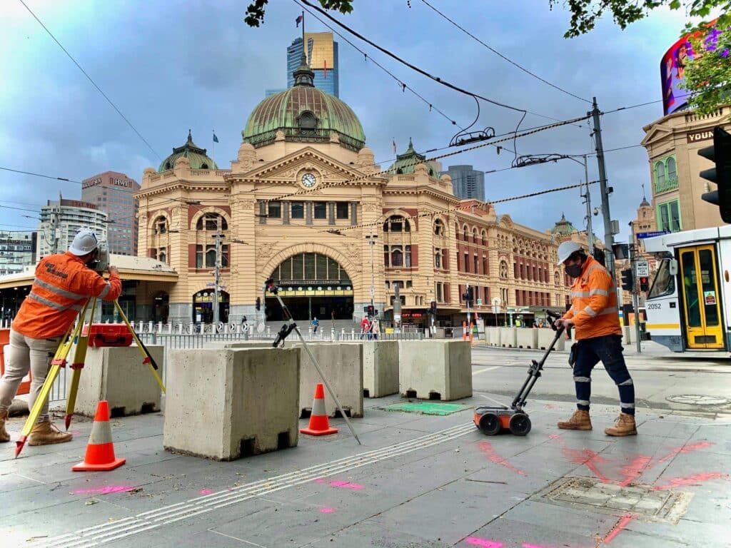
Utility mapping involves several steps and relies on specialised expertise and technologies to accurately identify and document underground utility locations. Not all techniques are created equal – QEST Infrastructure provides utility mapping services using cutting-edge technology, provided by a team with over 2 decades of on-the-ground and project management experience, without the need to involve third-party contractors.
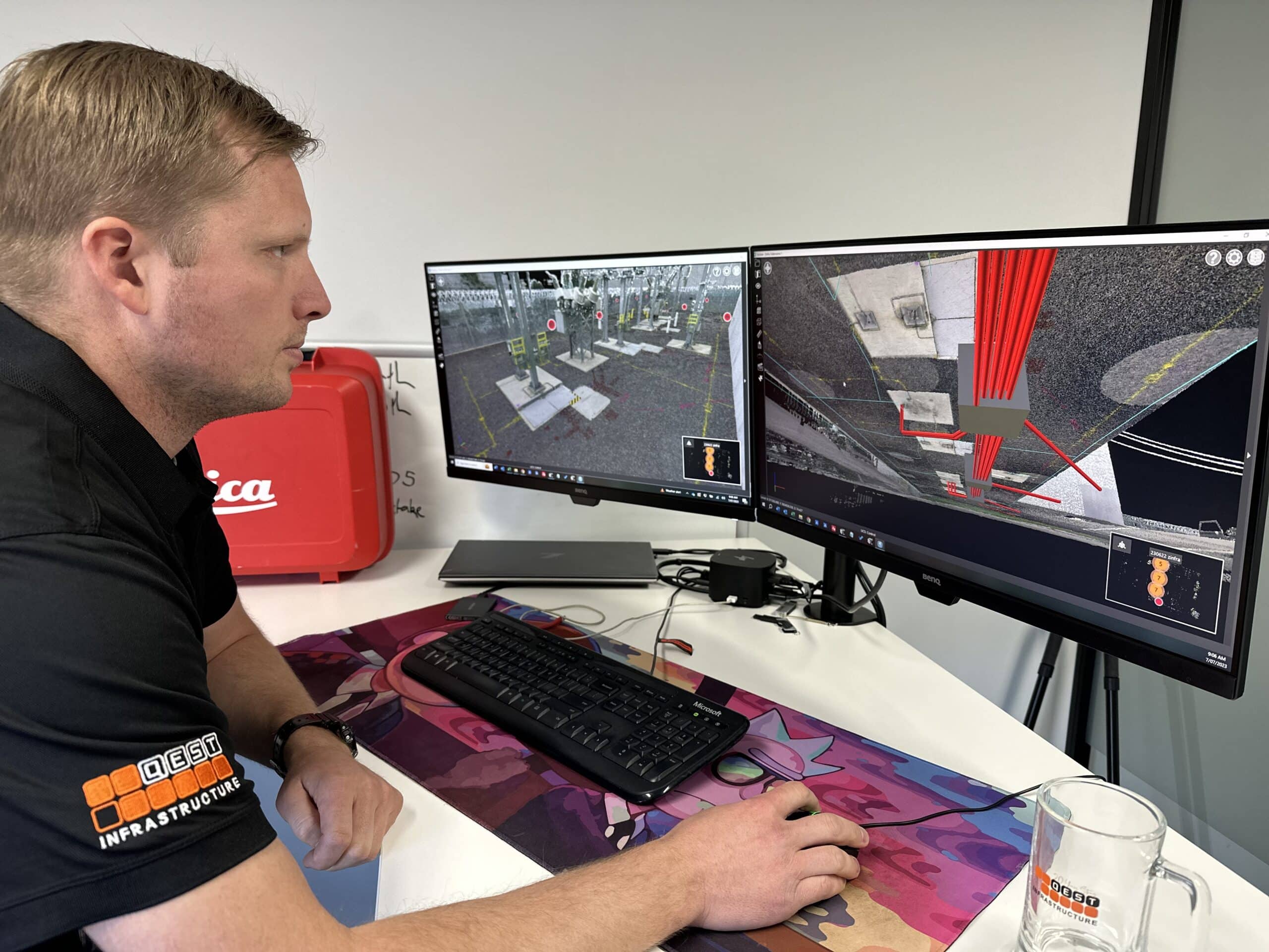
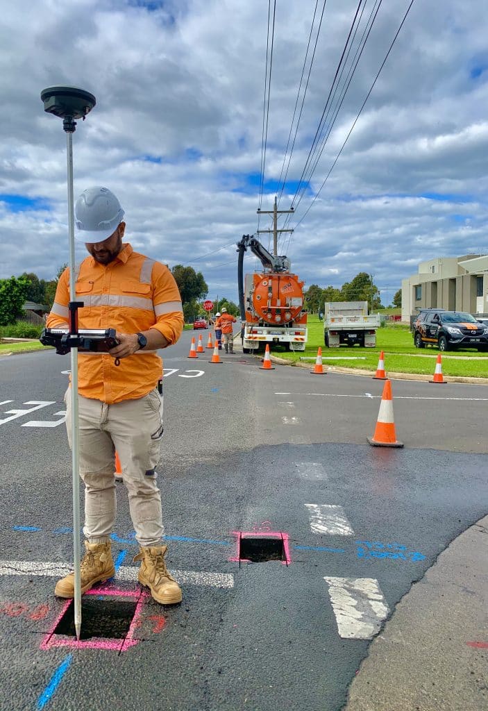
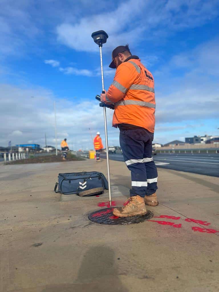
Utility mapping begins with a desktop study for initial data collection, followed by on-site inspections completed by our service locators and surveyors to record the underground utility locations and draft them onto CAD plans. We then perform hydro excavation to confirm asset locations, providing the most safe, timely, and cost-effective results, all with one point of contact.
QEST Infrastructure’s utility mapping services deliver a complete infrastructure map in CAD format on a NearMap overview with all findings and landscape features to a level of certainty you can rely on.
Why do I need utility locating services before starting a construction project?
Utility locating is a non-negotiable first step. No construction project can break ground without utility location services. It is impossible to know the complex web of underground infrastructure, such as electrical, telecommunication, and sewage lines, that may be in the footprint of your works without first engaging an expert to identify underground utility locations.
Utility mapping is the next level of detail to service locating. Finding a service and marking the ground with paint does not deliver the level of quality and safety a client is looking for. Once a service has been electronically located, its location must be confirmed utilising hydro excavation and be picked up by a surveyor with the data stored. This is the only certain way that the underground utility location can be known after it has been reburied. As construction progresses, ground conditions change. Pavement is constructed and services may be installed that have not been recorded. This is why utility locating is a paramount component of any construction project. The growing number of underground utilities pose significant risks during excavation, making accurate utility locating essential in safeguarding your timeline, budget, and workers’ safety.
At QEST Infrastructure, our timely and accurate utility detection and mapping uses industry-leading approaches and technologies, helping our clients to mitigate the risk of costly delays and injuries. Our expert utility locating services are an indispensable investment for a hassle-free and safe construction project.
What types of utilities can be mapped and located?
All underground utilities, including water, gas, sewer, stormwater, telecommunications, and electrical services, steam and air lines, oil and fuel transmission lines, and underground storage tanks, can be located and mapped utilizing QEST Infrastructure’s advanced utility mapping technologies. Because we leverage hydro excavation and surveying to expose, confirm and record the location of underground assets, our underground utility locating methods are the complete project package. This approach ensures excavation project risks such as delays, injuries or dangerous accidents are minimised. QEST Infrastructure is the right choice for all of your utility mapping and underground utility locating needs.
How accurate are infrastructure/utility mapping services?
Not all utility mapping services are created equal, with varying levels of accuracy. QEST Infrastructure’s utility location services are industry-leading and prioritise accuracy. Infrastructure mapping accuracy depends on the methods utilised which will be determined by: The asset being located, its condition, location, the constraints around the asset and the quality level required by the client.
The only certain method of confirming exact underground utility locations is a positive identification via hydro excavation, which exposes underground assets allowing visual confirmation of the service type and location. Clients of QEST Infrastructure receive professionally presented and accurate CAD plans which present the data and its level of accuracy.
How long does it take to complete infrastructure/utility mapping for a specific area?
The timeframe for completing utility mapping in a specific area depends on factors like the size and complexity of the site, density of utilities, accessibility, and the availability of accurate records. Utilising the latest service locating technologies coupled with hydro excavation, our utility location services prioritise both speed and precision.
At QEST Infrastructure, our team has over 2 decades of expertise in underground infrastructure management and have dealt with almost every hurdle affecting project timelines, so you can trust us to not only meet but exceed your expectations of utility mapping services ensuring timely and accurate project delivery.
Can utility mapping services prevent utility-related accidents completely?
While there is no way to completely remove the risk of asset strike due to human error, utility mapping of underground utility locations significantly mitigates the risk of utility-related accidents.
QEST Infrastructure’s advanced technologies and holistic approach to infrastructure mapping ensures complete and successful mapping of all locatable underground services in the area. Incomplete methods of utility mapping fail to adequately mitigate risk for projects and are not able to be referenced later in the project. With one point of contact, QEST offers and promotes the best mitigation method that exists – managing the detection and physical location of the asset, without the risk of multiple contractors not controlling the process. For design purposes only, some clients will only require the detection of underground services via an accredited locator. It is industry best practice for all excavation works, and essential for all major projects, to engage utility mapping services which utilise positive identification methods (such as hydro excavation).
Why should you trust QEST Infrastructure’s utility mapping and locating services for your projects?
QEST Infrastructure is an industry leader in underground utility locating and utility mapping. Our team has over 2 decades of on-the-ground and project management experience and our accredited field technicians are committed to client satisfaction, clear communication, and the successful and timely delivery of every project. “If the client is not satisfied, then neither are we”.
What differentiates us from our competitors? We are the only provider of a complete solution to underground asset assessment and management providing Service Location, Geotechnical and Environmental Drilling, Surveying, Hydro Excavation, CCTV, Drain Cleaning, Industrial High Pressure Jetting, 3D Scanning, Drone Flight Surveying, and CAD Drafting. By providing a single point of contact, we provide personal and simplified assistance with your project. “One call does it all” – client testimonial.
Do infrastructure/utility mapping services provide post-mapping documentation?
QEST Infrastructure provides post-mapping documentation for all utility mapping services. We deliver a complete infrastructure map drafted in CAD format and NearMap overview with all assets and features, indicating the level of certainty obtained through our field investigation. We ensure our clients possess the necessary documentation and information for informed decision-making throughout their projects.