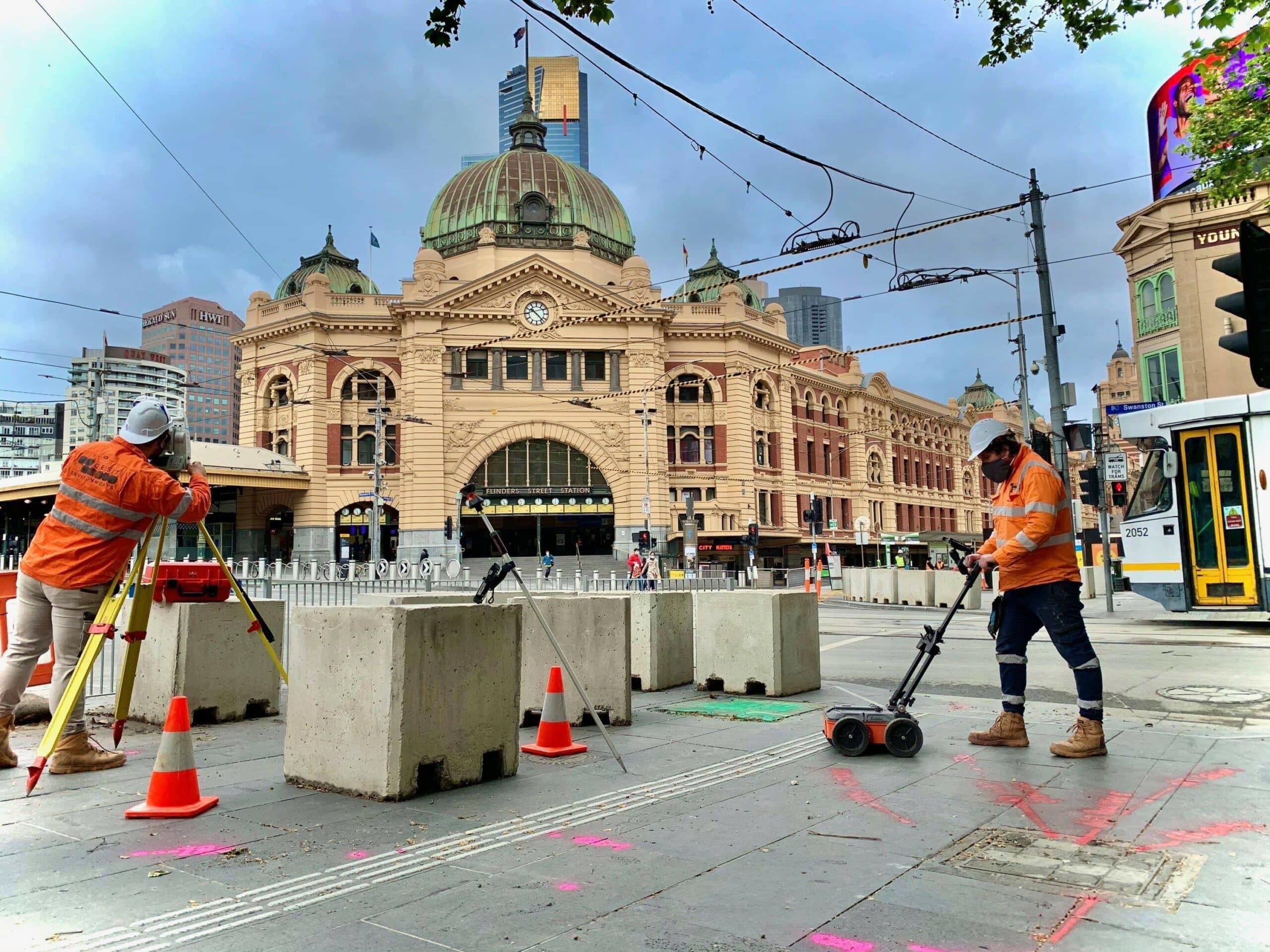
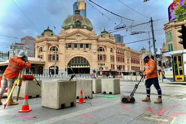
Feature and Levels Surveying
At QEST Infrastructure, we specialise in delivering comprehensive Feature Survey and Level Survey services. With over 2 decades of on-the-ground and project management experience, we are a trusted provider of surveying solutions to government entities, private developers, and commercial clients. By utilising the best available technology and techniques, QEST surveyors deliver accurate and timely assessments of our clients projects.
We pride ourselves on providing a seamless and hassle-free experience for our clients. With one point of contact from project commencement to completion, our clients experience the convenience of “One call does it all”. If you’re considering whether you need a Topographic Survey or Site Levelling Survey for your project, contact us today to understand how our services can be tailored to your needs.

What is a feature survey?
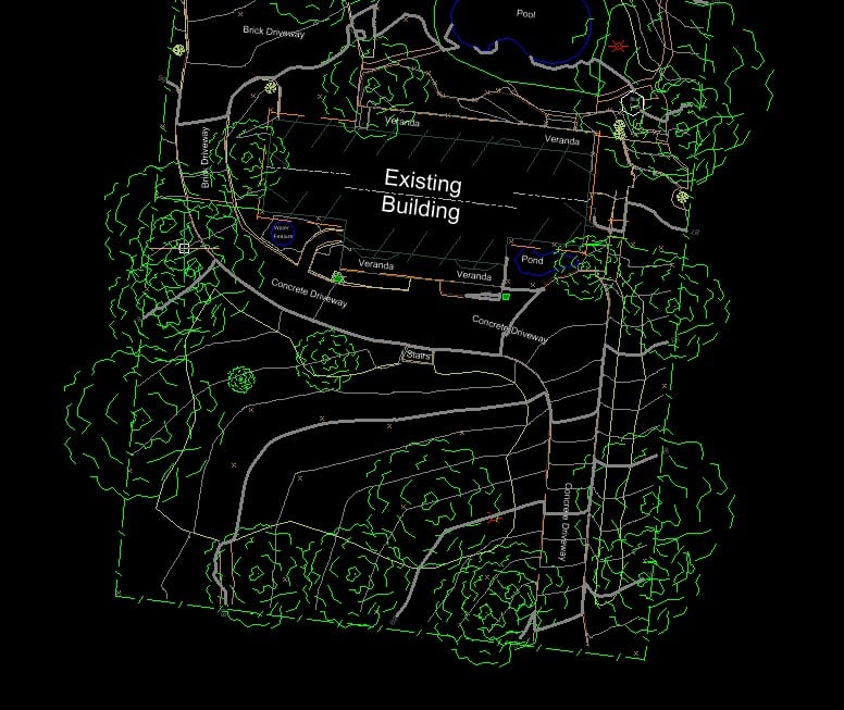
A Feature Survey is an essential first step for any development, providing a detailed overview of a site’s physical characteristics. This survey captures data on land contours, elevations, and the location of both natural and built elements. Also known as a Topographic Survey, a Feature Survey accurately maps the terrain and existing site features for use in planning and design.
A Feature Survey Report informs stakeholders and ensures that architects, engineers, and planners have the precise information needed to guide their decisions, making it indispensable for construction and development projects.
What is the purpose of a land survey for features?
A Land Survey for Features documents the existing conditions and features of a land parcel, critical for decision-making in construction, development, and planning processes. A Feature Survey identifies natural landforms, man-made structures, and utility lines, facilitating project planning and execution.
A Feature Survey Report becomes an indispensable tool for architects and engineers, and is key to ensuring your project respects legal property boundaries. An accurate Feature Survey minimises the risk of potential disputes and costly project delays, and enables informed and efficient project decision-making.
What does a topographic survey include?
A Topographic Survey involves a comprehensive mapping of a site’s terrain, capturing details such as elevation changes, land contours, and both natural and built features. Specifically, a Feature Survey may include utility services (like electricity, sewerage, gas, and water), retaining walls, fences, and details of neighbouring properties (like eave height, ridge height, and setbacks).
A Topographic Survey guides architects, engineers, and planners to design developments that are adapted to the natural landscape, anticipate potential challenges, and develop effective solutions.
Can a feature survey identify existing structures and trees on a site?
A Feature Survey is specifically designed to identify and document existing structures, trees, and other natural and built features on a site. Also known as a Land Survey for Features or a Topographical Survey, this survey provides a detailed overview of the property’s current conditions, which is crucial for planning and development.
The accuracy and comprehensiveness of a Feature Survey enables your project team to make informed decisions, incorporating existing site features into your project plans effectively. An accurate Feature Survey Report is an essential foundation to any successful development.
What is the importance of differential levelling in surveying?
Differential levelling is the most precise technique used in a Site Levelling Survey to measure vertical distances between points across a site. This method involves a series of set-ups of the instrument, where at each set-up there is a rod-reading back to the point of known elevation and forward to a point of unknown elevation.
Differential levelling is vital for producing accurate Level Survey Reports, essential for the initial phases of a Feature Survey and also for carrying out an accurate Survey for Drainage Features (key to ensuring water flow is managed properly on site).
The precision offered by differential levelling can significantly impact the success of a project, by ensuring that all construction is based on the most accurate ground data available.
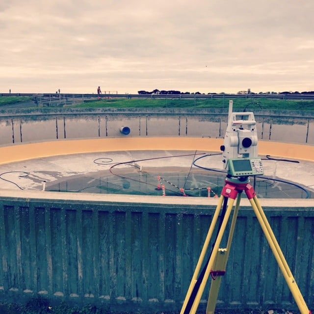
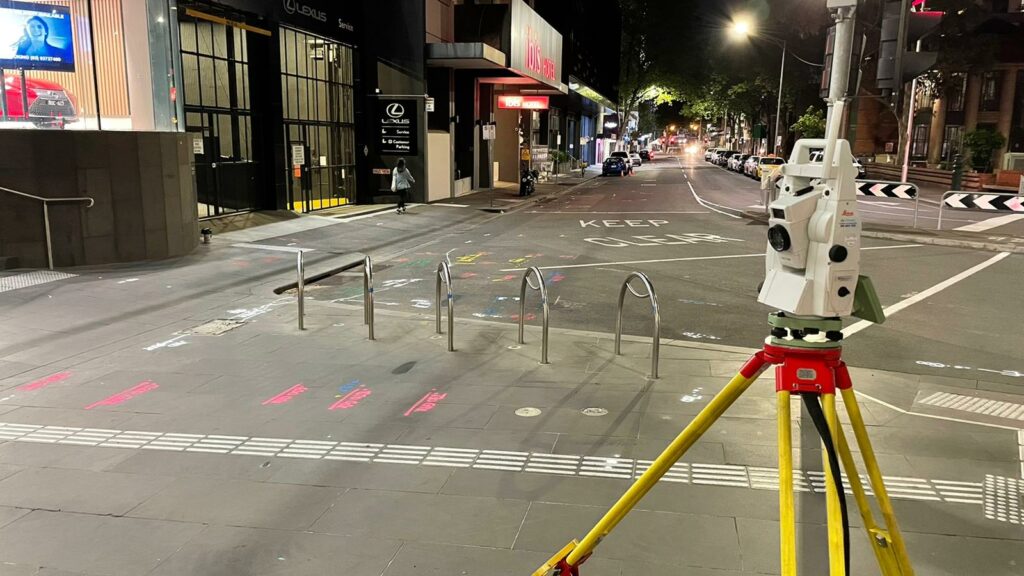
What equipment is used in a level survey?
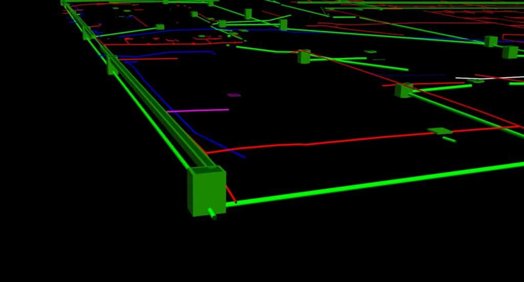
In a Level Survey, a range of specialised equipment is employed to ensure the highest degree of accuracy in measuring land elevations. This includes optical levels (also known as ‘dumpy levels’), laser levels, and digital levels, all of which play a critical role in generating accurate Level Survey Reports. Additionally, the use of GPS technology enhances the precision of Level Survey Benchmarks, ensuring that every point measured is accurate and reliable.
Technology that sets QEST apart from other surveying companies is our ability to utilise our 3D laser scanning and Drone flight technologies to improve accuracy and efficiency for our clients. QEST’s expert surveyors accurately map terrain so our clients can plan and execute their projects with confidence.
What is the advantage of differential levelling?
Differential levelling is the most precise Level Survey technique, providing unmatched accuracy compared to trigonometric and barometric levelling. Differential levelling is used by surveyors to accurately determine vertical distances between points on a site, therefore ensuring elevational accuracy.
Highly accurate Level Survey Reports are essential for any construction or development project, mitigating potential construction challenges which can cause costly delays and budget blowouts. Conversely, a Level Survey using subpar techniques and attaining less accurate elevation data is likely to create issues which may not be realised until a project is significantly progressed. This is why your choice of Level Survey provider should be a key consideration in your project planning. Contact QEST Infrastructure today to find out more about our Site Levelling Survey services.